


Mapithel Dam Irrigation Canals: Stretch of Accountability Concerns
- Part 2 -
Mamta Lukram *
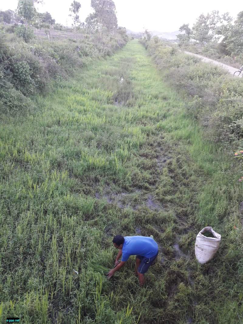
Locals collecting fodder from the canal at Icham Khunou (5th June, 2018)
Extended construction gaps, successive/selective stakeholder change-over and time lapse in initiating out the construction work raises concern over effectiveness, quality maintenance, canal alignments and finally over the anticipated success parameters. Efficiency remained the unfold question.
Audit scrutiny revealed the construction of the Thoubal Right Canal from RD 11.720 km to RD 12.00 km awarded in November 2002 included excavation and disposal of 2,44,075.94 cum of hard dense soil, which was disposed at a distance of 2km away from the work site whereas canal construction from RD 12 to 14 km awarded in 2006 included earthwork in banking of 1,69,394.625 cum of hard dense soil.
Had proper planning been done, the work could have taken up simultaneously, and the excavated earth could have been utilised for banking of the RD 12 to 14 km. This could have avoided extra expenditure of 1.76 crore. Canals of the Mapithel Dam left behind a legacy of unaccountability. Timeline events are the justified evidences.
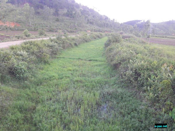
The long stretch of weedy cover canal lying defunct, when it was expected to supply irrigation water, during peak season June, 2018 (Icham Khunou)
The Thoubal Multipurpose irrigation canals constructed acquiring many hundred acres land from the villagers, particularly in Thoubal district could be seen all the way long going travelling across many villages like Icham Khunou, Lourembam, Lameithet, Pechi, Bengi, Wangjing, Khongjom, Sapam, Papal and so on. Interacting villagers of Icham Khunou whose land has been acquired for the canal construction, when enquired into barely have any idea of the purpose and objective of the canal.
With least knowledge of rights and entitlements, the villagers shared their mere ideas on specified proceedings of land acquisition like prior information, consultation, consent, compensation etc. Canal is only what they know. Further inquiring into the name of the project for which the land was acquired, one lady shared;
"Asss! Mamingadi khangdeda" (no idea of the name), whose project, which dam, which canal and what objectives are all about. We just know a canal is constructing. It was more like a rumour the information traverse across the village about the canal. Proceedings were rather informal. We don't how our village is linked with the Mapithel Dam (Thoubal Multipurpose Project) or else. We heard that dam is very beautiful. That's all we have heard and we also have no idea on how this canal is benefiting us (...laughter). Now is June; rainy season; you must have seen the water volume content of the canal.
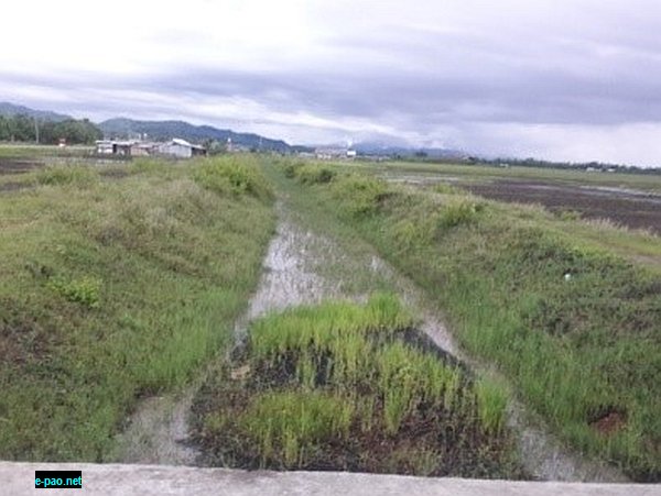
Along AH2 before reaching Khonjom, Elangbam Leikai Canal, exhibiting underperformance, blocked by weedy fill, during peak monsoon season (23rd June 2018)
Efforts are on for land Heirok canal land acquisition. Also, land (9.98 ha) required for Lausi Pat Distributary, and Thoubal Right Canal from RD 25.935 to 28 km is mentioned to have not been acquired. Special emphasise is laid on the further completion of the remaining canal works. In addition 1,200 ha and 900 ha of low lying areas of Lousipat and Poiroupat respectively have been reclaimed by Thoubal Multipurpose project. The project claimed to have completed main and branch canal 80% and distributaries to the extent of 29%.
In Thoubal District, Wangjing River, Khongjom River and many feeder streams can fed the agricultural fields for better yields. The state has been solely relying on the uneven monsoon for its subsistence agricultural farming until 1972-73, before any major and medium irrigation project was implemented in the state. Use of the High Yielding Variety (HYV) seeds, mechanisation, and modern methods of farming has no doubt enhanced the agricultural yields in the state, however the agricultural yield increased out of the implementation of the irrigation projects is doubtful.
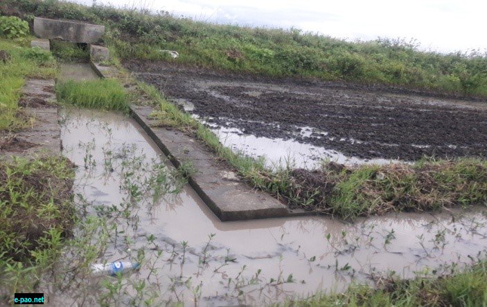
Less utility of the canal known by the farmers during the peak agricultural season, June 2018
Gross land acquisition of high yielding prime agricultural land surpassing people's dissent will afflict the state's gross product. The Economic Survey Manipur 2013-14, by the Directorate of Economics and Statistics, Government of Manipur, categorically stated that Thoubal district has the highest rice production in the state with 70.96 tonnes per annum (18.33 %), followed by Imphal East, 66.04 thousand tonnes (17.06 %) during the year 2011. This statistical account need be maintained unharmed.
Land loss due to unaccountable acquisition equates intimidating food sovereignty of the state. Reliability assessment need be pondered upon before people lose their land to unproductive projects.
Concluded....
* Mamta Lukram wrote this article for e-pao.net
The writer can be contacted at mamtalukram(AT)yahoo(DOT)com
This article was webcasted on October 30, 2018.
* Comments posted by users in this discussion thread and other parts of this site are opinions of the individuals posting them (whose user ID is displayed alongside) and not the views of e-pao.net. We strongly recommend that users exercise responsibility, sensitivity and caution over language while writing your opinions which will be seen and read by other users. Please read a complete Guideline on using comments on this website.


