


Without knowing our boundary, let us not try to defend it
Pemberton line in Kabaw Valley is our boundary
Dr Th Suresh Singh *
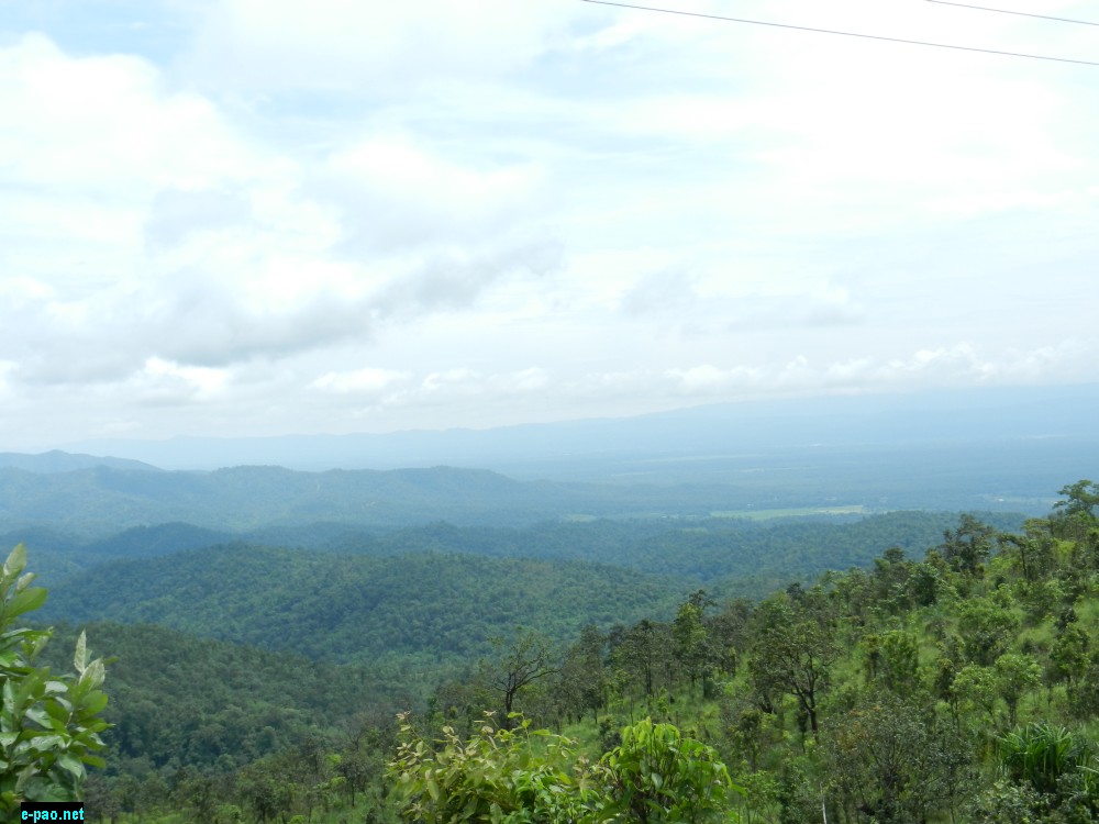
Kabow Valley in Burma (Myanmar) as seen from Imphal-Moreh Highway in August 2014
With the present hot scenario in our Burma border and a 3-member central team visiting Manipur for the same, your Opinion Maker is again compelled to write this article. This is the 3rd article I have dealt so far-the previous 2 being on 14/10/2012 and 11/04/2015 in this very newspaper and the Manipuri version being 15/10/2013 (series) and 02/04/202015 in Hueiyen Lanpao.
Last dispute prior to the present one : During March/April 2015, we had a hotly contested dispute with the Burmese Army constructing pillar inside Manipur's Holenphai Village (3 km south of Moreh Police station). However, that was not an isolated one in one or two pillars.
The dispute continues throughout the Indo-Burma border off and on. That dispute was not only in Holenphai Village, but in Border Post (BP) nos. 66, 76, 78, 79, 81, 89, 90, 91, 92, 93, 94 i.e. a total of 11 BP areas. This is according to Union Home Ministry'sown media cell release. At that time, Manipur Government constituted a 6 members high power committee with Dr. Suresh Babu, then Principal Secretary, Home, as Chairman. What happened to that committee, no one knows, nor we care for that. The adhocism continues.
Historical Facts : This off and on dispute is Kabaw Valley(KV) boundary dispute started with the signing of KV agreement on 9th January, 1834 by those incompetent 2 Britishers, namely R. B. Pemberton and F.J.Grant without Gambhir Singh's approval. The demarcation was done according to the now famously known Pemberton line. Because of its unclear demarcation, this line has made Manipuri boundary like a mass marriage with multiple spouses in Manipur's northern, eastern and southern frontier even today.
Eastern frontier : What is this Pemberton Line? It is an imaginary line drawn northwards from the KV in 1834 and doted in a map. The difficulty is that it was exactly defined by natural landmarks only along the western face of Kabaw Valley. North of this valley, the area at that time was uninhabited and the line running through it was never laid down on the ground. This unclear area has been described in the agreement as "a straight line passing due north from the north extremity of KV up to the first range of hills east of that upon which stand the villages of Cho-eetar, Noorgbree and Noonghur" of the Lahupa (or Tangkhul) tribe of Nagas".
With many disputes continuing, the then British Government was forced to appoint a 2nd Boundary commission to replace the imaginary Pemberton line of 1834 drawn northwards from KV. PA Cl. Johnstone was appointed as Boundary Commissioner. Johnstone and his party left Imphal on 16th December 1881 and returned on 9th January 1882. The Survey party, after meeting Samjok Chief and other Burmese officials, discovered a natural little steam that could form the boundary line in accordance with the terms laid down in Pemberton definition.
The lines are marked on the map. It is described as "The boundary thus fixed follows the base of the eastern slopes of the Malain range, crosses the river Namia a few hundred Yards south of Kongal Thanna, thence turns east to the Talain River, follows that river upward to its source, and then proceeds down the Napanga River to where it passes through a gorge in the Kusom Range. From thence it runs northward along the crest of that range.
The points where the boundary intersects the Namia River and touches the Talain River have been marked with pillars, and road map has been cut connecting these two points". In this survey, PA Johnstone gave away a large portion of KV which previously belonged to Manipur. This was never compensated. That Johnstone worked against Manipur, though he pretends to be a well-wisher and a lover of Manipur in his book, was highlighted in my book and elsewhere.
In the North frontier In 1835, the forest between Doyang River and Dhunsiri River was boundary between Manipur and Assam. With trouble mounting in this sector as well, the British Govt. was compelled to appoint a Boundary Commission in 1872. Thus the 1st Boundary Commission, which is also often referred to as Golwin and Auten Boundary Commission, was formed.
After repeated surveys, the northern frontier boundary eastward of Telizo was settled in March 1874 by finally laying down a line. Manipur accepted this reluctantly as we were supposed to get more, but could not. Cheitherol Kumpaba mentions that stone bearing the King Chandrakirti's name was fixed in the boundary. Dr. Brown, Thangal Major and Thumjao Purel represented Manipur in the said final settlement.
Southern frontier : As per 1834 Treaty, " the southern boundary of Manipur from the east begins at a point where the river called by the Burmese Nansawing, and by the Manipuris Numsaulung , inters the plain, up to its sources and across the hills due west down to the Khothi Khyoung ( Manipur River)".
British writers are on record that, "according to this Treaty, part of the Sootie tribe at present lives in Manipur and part in Burmese or independent territory". This implies that part of the Sootie area south of the present Manipur boundary definitely belonged to Manipur. The remaining area are independent or semi-independent of Burma.
It is no surprise that the whole Sootie area had been handed over to the Burmese later on. Thus, because of Manipur's inconsistency in boundary negotiations and failure to present and negotiate with facts, we had lost vast tracts to the Burmese in the past; it continues to do so now also.
Lost of territory : Since Merger, Manipur has lost about 1000 sq.km. The loss includes-
i) About ½ km or so area beyond present Mao gate to Nagaland. I still distinctly remember there was our 1 TB sanatorium while passing to Dibrugarh during my study days. Who gave away this?
ii) Present road from Burma's Namphalong Bazar to gate 1 Bridge. It definitely was Manipur's while I was posted as MO i/c at Moreh during 1975-77. Again who gave it away? Did we get compensation elsewhere?
iii) Other areas secretly taken away by Burma and Nagaland.
Besides this, we should also remember that Chandrakirti also handed over Kohima, (conquered by his famous father Maharaj Gambhir Singh in his famous campaign lasting 9 weeks-famous Khepumei/Kohima campaign starting 28/12/1832), to the British without getting any equivalent compensation. The same is now part of Nagaland.
What is to be done ? : Our intellectuals, Civil Societies and Politicians should dispense with adhocism. They also should refer to undisputable historical facts mentioned above without which our arguments will become hollow and boneless.
Suggested treatment lines : Urge the Central Govt. to appoint a 3rd Manipur-Burma boundary Commission to solve it permanently and not in a piecemeal manner.
Meanwhile, we also should try to recover areas mentioned in i) & ii) above immediately.
NB: The reader may refer to my book " The Endless Kabaw Valley" for detail reference.
* Dr Th Suresh Singh wrote this article for The Sangai Express
The writer is Ex-Director, Health & WHO Fellow
This article was posted on August 06, 2018.
* Comments posted by users in this discussion thread and other parts of this site are opinions of the individuals posting them (whose user ID is displayed alongside) and not the views of e-pao.net. We strongly recommend that users exercise responsibility, sensitivity and caution over language while writing your opinions which will be seen and read by other users. Please read a complete Guideline on using comments on this website.


