


Training on remote sensing, GIS concludes
Source: Chronicle News Service
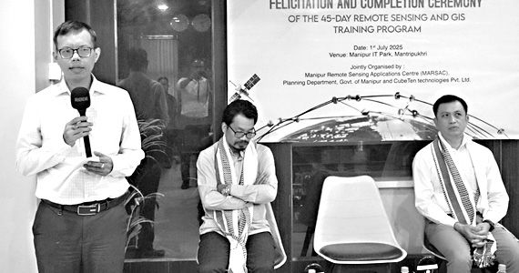
Imphal, July 02 2025:
A 45-day intensive training programme on Remote Sensing and Geographic Information System (GIS), jointly organised by CubeTen Technologies Pvt Ltd and Manipur Remote Sensing Applications Centre (MARSAC), concluded on Wednesday at the Manipur IT Park office of CubeTen.
The training held since midMay and participated by over 30 professionals, scholars and young technical graduates, was aimed at familiarising the participants on advanced skills in geospatial technologies.
The training covered a wide range, of subjects, including satellite data interpretation, GIS mapping techniques, UAV-based data acquisition and real-time applications in administration.
|
Both theoretical and practical sessions were conducted by experts and trainers from reputed central government research centres and institutions.
Notably, scientists from the North Eastern Space Applications Centre (NE-SAC) led the main sessions of the programme.
Personnel of departments such as Environment and Climate Change, Information and Public'Relations, Central Agricultural University, Minor Irrigation, and Planning and Development Authority also took part in the training.
Speaking as chief guest of the valedictory function, Information Technology secretary Thokchom Kirankumar highlighted that the reliance on GIS and remote sensing technologies has been steadily increasing in the execution of various developmental projects for the public.
He said that these technologies play a crucial role in addressing challenges such as flood management, water supply monitoring, urban infrastructure planning, land use mapping and tracking agricultural produce.
In his speech, MARSAC director O Nodiachand Singh highlighted the importance of GIS in decision-making, resource mapping and environmental monitoring.
"In a geographically complex state like Manipur, where diverse developmental approaches are required, it is essential for planners and policymakers to possess the ability to understand and analyse spatial data effectively," Nodiachand emphasised.
 Comment

