


Global water and water in Manipur
- Part 1 -
Dr H Nandiram Sharma *
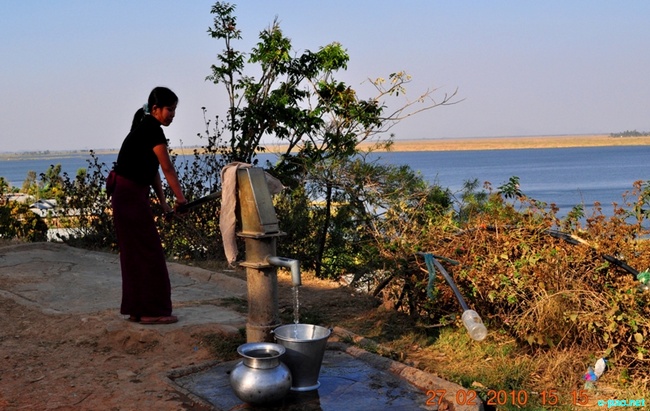
Collecting water from a Hand pump near Loktak Lake in Februray 2010 :: Pix - Thingom Premarani
The Earth is a unique medium size planet of the Sun's family in our galaxy- The MilkyWay' possessing approximately 1,386,528,500km³ of water in three states-solid,liquid and vapour in optimal proportion. It covers three fourth of the surface of the earth with nearly half of it in the pacific ocean. A slight fluctuation (man-made or natural) of the optimism at the impact of physical and biological factors of the earthly natural system amounts to a disastrous condition. Glaciation that visited the earth five times and later, after the emergence of modern man, the disastrous flood recorded in the vedic literature and old testament of the bible are the evidences of it.
Proportion of water in different physical states and qualities. 97% (approx.1,344,932,645 km³) in oceans and seas in saline liquid state. 2.5%-2.75% (approx. 34,663,212.5km³- 37,436,269.5km³) in fresh solid state in Ice caps,Glaciers,Snow and in fresh or saline liquid state as ground water. 0.01% (approx.138,652.85km³) in fresh liquid state in lakes, swamps and rivers. 0.04% (approx.554,611.40km³) in vapour state in the atmosphere. 0.003% (approx.41,595.855 km³) in the form of unpolluted fresh liquid state available globally, the very meagre quantity of usable water for mankind and other biological diversities on the land. This fresh liquid state of water on the land may be collectively called 'Inland Water' 87% of this fresh surface water are in lakes including 29% in the African Great lakes,23% in Lake Baikal of Russia, 21% in North American Great Lakes and 14% in other lakes including the so-called lakes of Manipur (Loktak and others).
Resource of fresh water:-
Fresh water in renewable and variable but with definite natural resources. It can get replenished through the process of water cycle. Water from oceans, seas, lakes, rivers, other inland water bodies and forest evaporates, forms cloud and returns as precipitation. A deterioration in this cycle will have disastrous impact on the sustenance of the earthly environment in general and land environment in particular.
Water in Manipur
The altitude of Manipur is critical. It is neither high to have snow clad zone unlike the Himalayas nor low to have backwater as in Kerela. The only source of water of this region is rain like Nagaland, Mizoram partly Assam, Tripura and other states, south to the Vindyas. It is quite different from other states in the north India, Arunachal and Sikkim in the North East India having rivers fed with snow throughout the year.
Natural unique feature of Manipur
Manipur by virtue of its location in the most cloud conjested zone of the globe, just on the western margin of the Great Triangle and just on the north of the Tropic of Cancer, is gifted with a large quantity of rain, to some extent like Moushinram in Meghalaya (the spot of the highest rainfall in the world). The catchment capability of this region is evident by a number of rivers and rivulets flowing into the Iravadi in Myanmar on the east and Brahmaputra of Assam on the West.
Beside the outward drain to the east and the West there are rivers like Khuga, Moirang, Lokchao, Nambal, Nambul, Imphal, Kongba, Iril, Thoubal, Sekmai, Chakpi plus a number of rivulets draining the hill ranges which fringe the central valley with a network of feeding hill streams. These are the sources of water of the central valley and narrow valleys in the hills. All these merging together flow towards the south via Loktak the sub-reserviour as the Manipur River and down ward as Chingnoonghoot at the Southern boundary of the state.
Some of the important rivers the water of which can be trapped for hilly region are Makru,Barak, Irang, Ijai, Leimatak, Tubai, Maklang, Taretlok, Tuyungbi, Sanarok, Nungsang Khong etc.
The topography of Manipur is, very much uneven ranging from 760 msl (central valley to 2994 msl (Mt Iso/Tenepu at Mao in Senapati district) with an inclination towards the zodiac. The altitude of Jiribam is much lower exceptionally. Multiple hill ranges surround the bowl shaped central valley of approx. one tenth of the total gographical area (22327km³). By virtue of consequent variations of light & shade and humidity there are potentials of microclimatic condition nourishing a rich biodiversity of biomes somewhat similar to those of the northern hemisphere excepting Tundra hence identified as a part of 'Indo Myanmar Mega Hot Spot'.
Manipur in the past
It is partly an assumption and partly based on old scripts and stratography of soil of the central valley upto an average depth of 66m (personal observation during drilling of tube wells). Approximately, nine tenth of the geographical area of the state i.e hilly region was clad with luxuriant forest with very high potential of natural harvesting and storing rain water on the surface and underground (aquifer).And,approximately one tenth of the area, i.e, central valley and narrow valleys between the parallel hill ranges acted as accumulating zone of water. The central valley was a big lake fed with torrential rain precipitated by thick luxuriant forest and draining system of the hilly region. Obstructed by Sugru Hump, water accumulated in this lake in terms of cubic kilometers. Monitored by forest on the hill and big water body in the valley the then environment was as ideal as that of paradise.
Man-made devices cannot replace this natural process of harvesting and storing water in this magnitude i.e irreplaceable.
Present scenario of Manipur
As per report of IMD (Indian Meteorological Deptt) the annual rainfall quantum of Manipur varies from 956mm (approx.21.4km³) to 2269.9mm (approx.50.7 km³) Maximum rainfall is in the months of June and July. If the whole area of Manipur were plain through out , it would have been underneath a depth of approx.1m of water with the lower rainfall and approx.2m of water with the higher rainfall.
As per the weather column of the Hindu (newspaper) the rainfall of Imphal in three months of two consecutive years are 2012: 476mm from the 1st June to the 31st August. 2013: 765mm from the 1st June to the 26th August.
Inspite of heavy rainfall during three months of immediate previous year there is acute shortage of water in the months of April 2014 drying up a number of water bodies, rivulets, brooks and rivers to the extent of ' Singda water Reserviour' being shrunken to the floor as forecast 10 years back. It is lucky, it is not yet filled up with a mud slide like that of the havoc at Gopipung of Senapati district some years back.
Water condition is already worse in the hilly region. Life became harsh there, hence enforced climatic migration right from the thirties of the twentieth century. In near future such a migration from the valley too may be seen unless the people are aware of the present environmental condition.
It is speculated, in the Pleistocene some 10,000 years back, 50% of the land of the globe was covered with forest (UNFCCC:UN Framework Convention of Climate Change) when approx.90% of the total geographical area of Manipur was with luxuriant mixed forest. Presently, the global status has reduced to 30% of the total land surface including only 10% of primary status due to hostile aptitude and erroneous activities of man.
The present forest status of Manipur, according to state official report, is 67.9% including 10% of primary forest of the total geographical area. One needs personal observation if it is so what is being claimed by the Govt. of Manipur. The people of this land may kindly not be befooled.
Koubru range, far beyond the Koubru peak in the north, upto Thangjing and beyond in the South, and north eastern part of Senapati district, the catchment of rivers that water Imphal valley are not with commendable environmental status. Yet it is not too late to get taken care of the forest thereon with committed efforts. Such a positive step is called for other rivers too irrespective of hills and plain.
Owing to natural slow siltation through ages, the big lake in the Central valley shrank into 500 lakes some hundred years back. Later, consequent to gradual deterioration of forest and faster siltation it further reduced to 50 lakes and presently only 5 wetlands could be seen ( water body less than 6m depth is called wetland).
To be continued ..
* Dr H Nandiram Sharma wrote this article for The Sangai Express
This article was posted on May 24, 2014.
* Comments posted by users in this discussion thread and other parts of this site are opinions of the individuals posting them (whose user ID is displayed alongside) and not the views of e-pao.net. We strongly recommend that users exercise responsibility, sensitivity and caution over language while writing your opinions which will be seen and read by other users. Please read a complete Guideline on using comments on this website.


