


Floods in Imphal valley : Causes, effects and preventive measures
- Part 1 -
Laishram Sherjit Singh *
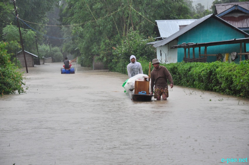
Scene of Flooding in Sugunu area/Serou area on August 2 2015 :: Pix - Deepak Oinam
INTRODUCTION
Manipur is a small state located in a hilly terrain with a small portion of valley. It has a complex geology, terrain, geomorphology, and lithology. Imphal valley is a palaeo-lake basin. Most of the lakes in the basin had now vanished in the course of time. Many natural groundwater recharging structures like ponds, tanks and swampy areas are greatly reduced due to urbanization and change in land-use pattern .Rivers are greatly polluted in many parts of the state. Breaching of river banks, heavy precipitation, Inadequate drainage facility and siltation are the main causes of floods in Manipur.
Urbanization and changing environment enhances the problem. Floods are among the most common and destructive natural hazards causing extensive damages to infrastructure, public and private services, environment and economy. The frequency and intensity of floods has grown in the State over the years primarily because of the unplanned development and increased encroachment of flood plains.
GEOLOGICAL SETTING OF MANIPUR
The geological framework of Manipur including Indo-Myanmar ranges along its eastern frontier is closely linked up with the evolution of Neogene Surma basin, Inner Palaeogene fold belt and Ophiolite suture zone. The ophiolite belt occurring along Indo-Myanmar border in Manipur, forms a part of Naga-Arakan Yoma flysch trough of Upper Cretaceous-Middle Miocene age. The rock formations consist mainly of flysch sediments of Tertiary ages comprising Disang (thick sequence of splintery shales) and Barail group of rocks (intercalation of shales, siltstones and sandstones).
Structurally and tectonically the studied area falls in a zone where the rocks have been evolved as a part of the imbricate thrust system of the Indo-Myanmar Ranges (IMR) during the subduction of the Indian Plate below the Myanmar plate. In the process, the younger litho-units (Barail in the area) have overthrusted the older ones (Disang in the area) giving rise to the tectonostratigraphic sequence as represented in Table 1.
Disang Group covers a major part of eastern and central segment of the state. Disang represents a great thick pile of splintery, dark grey to black shales interbedded with siltstone and fine grained sandstones (Mallet, 1876). These rocks occupy major portion of the section. The splintery nature is mainly due to the intersection of bedding and fracture cleavages (Hemanta, 2004). The splinters are rhomboid in shape, brown to reddish brown in colour due to weathering. The Disangs sometimes show intercalations of shales, siltstones and fine grained sandstones giving rise to rhythmite bedding. The valley fill of Plio-Quaternary age consists of clay, sand and gravel deposited in a fluvio-lacustrine environment.
Table 1: Tectono-stratigraphic sequence of the study area (Soibam, 2000)
Tectonic Province Lithostratigraphic unit Age
Myanmar Plate Metamorphic Belt Pre- Mesozoic Thrust Fault
Ophiolite Mélange Ophiolite suite and Lower Eocene
Belt associated sediments. to Upper Cretaceous Thrust Fault
Disang Group Eocene to Upper Cretaceous
Disang-Barail Thrust Fault (partly) (Central flysch belt Manipur Flysch Belt)
Barail Group Oligocene to Upper Eocene
FLOOD-PRONE AREAS
River flooding is a regular hazard faced by the State. All the major river systems in the State are vulnerable to flooding, as captured in the Vulnerability Atlas The high stream velocity of the Thoubal river causes breaching of river banks at Okram, Sabaltongba, Khekman, Ningombam, Leishangthem, Phoudel and Haokha. The confluence of the Imphal river with the Iril river at Lilong, makes it voluminous and rapid, causing the breach of embankment in Chajing, Haoreibi, Samurou and Lilong. Khuga River flows through strong to steep slope.
Hence river velocity is moderate to high, creating flood problem in Kumbi and Ithai Village The Chakpi River meets the Manipur River at a reverse direction causing flood in surrounding areas of Sugnu extending upto Wangoo during rainy season. Most of the embankments are poorly maintained. Many vulnerable points in Imphal river Thoubal river and Iril river were identified. The rapid increase in the valleys built- up areas is also an important factor for the recent increase in flash floods in urban areas.
PHYSIOGRAPHY OF IMPHAL VALLEY
Imphal valley was formed by the filling up of an ancient Lake which once cover the whole valley . Such plain is called Lacustrine plain. A part of the ancient Lake is still found in the southern part of the valley. This fresh water Lake is called Loktak. The process of silting can be seen in this Lake. Imphal valley is not smooth. Isolated hills and low winding ridges are found scattered throughout the valley. Since slope of the valley is from north to south, most of the rivers rise in the highlands of the north and flows towards the south.
The two most important river basins of the state Manipur are Imphal river basin and Barak river basin. Imphal river and its tributaries drain the central part of the valley and while western part is mainly drain by the Barak and its tributaries. The Eastern ridge line of the western hills forms the water divide between the Barak and the Imphal river basin. The Barak river basin belongs to Brahmaputra river system of the west and the Imphal river basin is a part of the Chindwin-Irrawady river system of the east.
The study area falls in Imphal river basin. Imphal valley is drained by Imphal river and its tributaries. The river rises in the highlands to the west of Kangpokpi and flows towards the north on the way, the river is joined by many tributaries like the Sekmai, the Thoubal, the Kongba and the Iril. Among them the Thoubal and the Iril are more important. The Iril river rises in the western part of the Mao and flows southwards to join Imphal river at Lilong. The Thoubal river rises in the Huimi hills of Ukhrul. it flows south westwards and joins the Imphal river at Mayang Imphal.
The Imphal river does not fall in the Loktak, rather it flows in the eastern part of the Lake. Khordak river drains the water of the Loktak to the Imphal river. In the south of the Loktak, the Imphal river is known as Manipur river, and it is joined by the tributaries- the Khuga and the Chakpi. The Khuga river rises in the Thinghat hills of Churchandpur district and flows eastwards to join the Manipur river at Ithai.
The Chakpi river originates from the Laimatol hills of Chandel District. It flows south-westwards and joined the Manipur river at Sugunu. The Manipur river crosses the southern boundary through narrow gorges and enters the Chin hills of Myanmar. In the Chin hills, it is joined by the Myittha and finally it falls into the Chindwin river of Myanmar.
The Nambul is another important river of Manipur that drains the Imphal valley. It rises in the Kangchup hills that lie in the western part of the valley .The river passes through the heart of of Imphal city and follows a course in the western of Imphal river till it falls into the Loktak..The Nambol (Maklang) rises in the Kangchup hills while the Moirang originates from the western hills of Moirang. The Imphal and the Nambul causes widespread floods in Imphal valley during rainy season.
To be continued...
* Laishram Sherjit Singh wrote this article for The Sangai Express
The writer can be reached at sherjitlaishram(at)gmail(doT)com
This article was posted on August 22, 2015.
* Comments posted by users in this discussion thread and other parts of this site are opinions of the individuals posting them (whose user ID is displayed alongside) and not the views of e-pao.net. We strongly recommend that users exercise responsibility, sensitivity and caution over language while writing your opinions which will be seen and read by other users. Please read a complete Guideline on using comments on this website.


