


Tamenglong - The Natural Paradise
Gaikhamdim Marangmei *
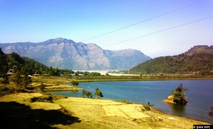
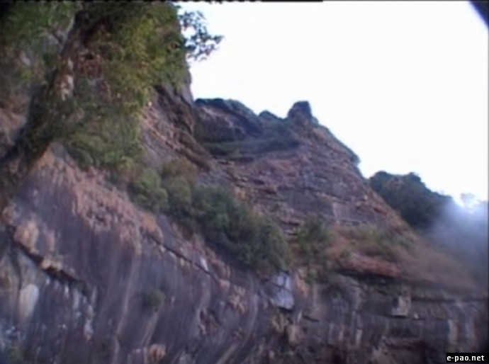
Nungba - Tamenglong - The Natural Paradise
The north-eastern block of India comprises of seven states, popularly known as seven sisters. Manipur is one of the states, which has been covered with fame and is known in every corner of the globe for its pure and rich cultural heritage also for Sports. Out of the state's eight districts, Tamenglong is located along the western boundary of the state.
Tamenglong is the land of exotic orchids. Tamenglong in Manipur is completely composed of hill ranges and narrow valleys. The hilltops and valley sides are dotted with small hamlets, located at strategic points. The land was believed to have been formed due to organic movement during cretaceous and Eocene period.
The main rock formations are sandstone, shale, schist. Due to weak and fragile nature of rocks and high gradient of the hill slopes, landslide is a common phenomenon in the whole district in rainy season.
Tamenglong district of Manipur is blessed with topography of irregular undulation. Tamenglong in Manipur has in its small area most of the awesome features that nature mould to a hilly terrain. Turbulent waters, roaring waterfall, pitching dark caves, enchanting lakes of the wilderness, rocks chiselled to wondrous form and yet the thick blanket of dense tropical forest most part of which are still virgin.
How to reach Tamenglong.
Airport : Imphal Airport, lies 8 km from Imphal city toward south. Imphal connects the place with Guwahati, Delhi, and Calcutta. Indian Airlines connects Imphal with Delhi via Guwahati on a daily basis.
Railhead : Dimapur, 215 km from Imphal, is the nearest railhead for Manipur. Tamenglong HQ can be reached through Roadways from Imphal (State Capital).
Road Transport : Imphal is connected by road with Dimapur by National Highway 39 and Silchar by National Highway 53. Tamenglong HQ can be reached through Roadways from Imphal (State Capital).
Places to visit in Tamenglong.
The Waterfalls at the River Barak
Along the river Barak there are seven waterfalls in series at close range. The picture is at the third step of the waterfall. One of them is Khoudong waterfall, Khoudong has an exotic look with the blue greenish water. Such paradise exist untouched by human hand, one may often see animals such as deer and monkey, and a must see for a water sport lovers for rafting and picnicking.
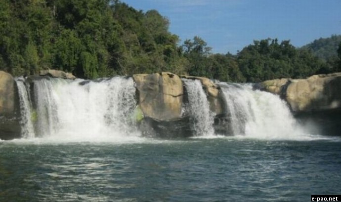
Khoudong Water Fall - Tamenglong - The Natural Paradise
Tharon Cave
Tharon cave is also spell as Thaeuluan Cave.It is about 27 km from Tamenglong, the district headquarters of Tamenglong District. The cave is 655.6 meters in length and features 34 joints and five exits. Excavations at the site had unearthed specimens related to the Hobinian culture of North Vietnam.A good ventilation system in the cave ensures that there is ample air circulation inside. The map of the entire cave is engraved and painted on a stone at the main entrance. This gives a clear picture of the alleys and turns inside the cave.
Zeilad lake
The legendary Zeilad Lake at Makoi (Atengba) in Tamenglong (Manipur India) is a natural habitat for a number of pythons, fishes and water birds. There are six other lakes nearby Guiphop Zei, Nrou Zei, and Nap-sam Zei etc.Zeilad Lake is located at Makoi (Atengba) off the west bank of the Barak, it is located at a high platform above a hill.
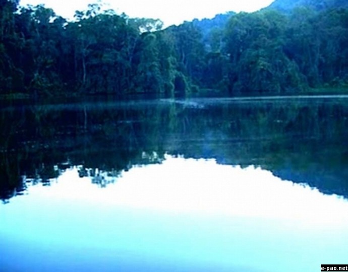
Zeilad lake - Tamenglong - The Natural Paradise
This legendary lake features in Naga myths as the place where paddy originated.This lake is assocaited with the Zeliangrong community as there is a legend where it is believed that Haipou Jadonang sittting on a white elephant when down the zeilad to get an medicine of immortal.The lake abounds in a number of pythons, tortoises, fishes and water birds. This lake is included among the four recently declared wildlife sanctuaries in Manipur.Zeilad Lake also hosts migratory birds every year.
Buning (N-piulong)
The Buning (N-piulong) meadow is located on the western side of the Tamei town. A number of well-groomed uneven small mounts, numerous glittering brooks studded the stretch.During the month of June the meadow is coloured with enchanting groud orchids and various wild lilies. Cry of Hoolock gibbon howling of foxes melodious chirping of birds altogether form Buning a big family of the wildlife evoking wonder and admiration of many who have witnessed the meadow.
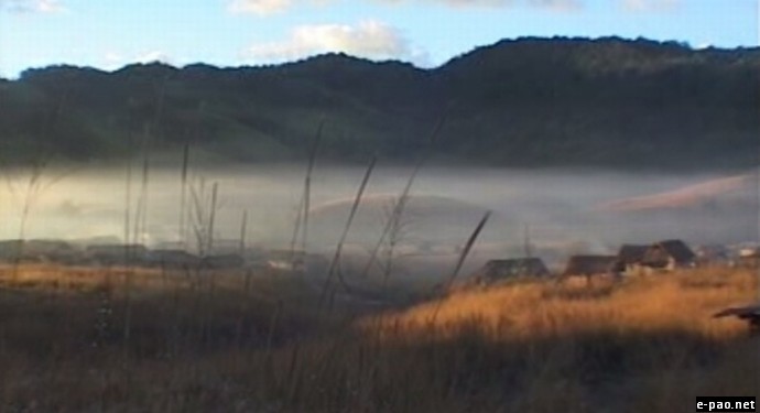
Buning - Tamenglong - The Natural Paradise
Mt Kisha
Mt Kisha locally known as Kachakhou is about 1462m above sea level in Magulong village of Tamenglong district Manipur, it imposing and majestic look with an awesome sedimentary rock structure is no ordinary site. This peak is considered sacred by the Zeliangrong people, there is a saying among the villagers that drinking and taking bath with the water found in the cave of Mt. Kasha can cure ailments and give suiting feeling to the body.
Mt Kisha - Tamenglong - The Natural Paradise
The cave has historical important as the Naga freedom fighter Rani Gaidinliu hide ones in this peak while on the run from the British in 1932 and from the Indian army in 1961. It is believed that garlic and ginger which are used locally originated from this peak. Mt Kisha with it splendour and pleasing environment is a feast for nature lovers as well as for mountaineer and trackers.
Kadai Ching
Kadai Ching is about 1 km from Tamenglong main town, from the top of this mountain one can get a view of Tamenglong town, here a cross have been erected by the Churches in Tamenglong town and serve as a prayer centre, it is a landmark of Tamenglong town.Kadai Ching is about 1 km from Tamenglong main town, from the top of this mountain one can get a view of Tamenglong town, here a cross have been erected by the Churches in Tamenglong town and serve as a prayer centre, it is a landmark of Tamenglong town.

Kadai Ching - Tamenglong - The Natural Paradise
A glance of the district is as below:
- Geographical Area : 4,391 sq Kms.
- Population : 1,11,493 (2001 cesus)
- Altitude: (above MSL) 1260 m
- Latitude (HQ): 24.59 N
- Longitude (HQ): 93.30 E
- Humidity : 76 (Min) 92 (Max)
- Rainfall (HQ): 3135 mm.
- Temparature: 31oC (Max)4oC (Min)
- Tamenglong
- Tamei
- Tousem
- Nungba
- Zeliangrong Nagas
- Kuki
- Chiru
- Hmar
- Khasi
- State Highways
- I.T. Road
- Old Cachar Road
- Tamenglong Khongsang Road
- Iyei
- Irang
- Barak
- Makru
* Gaikhamdim Marangmei contributes regularly to e-pao.net . The writer can be contacted at adim2b(at)gmail(dot)com or at this website here
This article was posted on October 24, 2011.
* Comments posted by users in this discussion thread and other parts of this site are opinions of the individuals posting them (whose user ID is displayed alongside) and not the views of e-pao.net. We strongly recommend that users exercise responsibility, sensitivity and caution over language while writing your opinions which will be seen and read by other users. Please read a complete Guideline on using comments on this website.


