


Recent Geomatics Training Course and N.E. People
By Dr. R.B. Thohe Pou *
"A learning man learns free of cost but a stubborn man learn with a high cost"
Recently there was Advance Training course on "Application of Geomatics in Natural Resource Appraisal and Management" in October 2008. This Advance course was sponsored by DST (Department of Science and Technology, Govt. of India, N.Delhi) and organized by Department of Geography, DDU Gorakhpur University, U.P. On this inaugural day, Dr. P. Nag - the first Geographer who became the Director of Survey of India and NATMO and Vice Chancellor of Gorakhpur University, graced in inaugural function.
There was an advertisement in Employment news in small column about this training course in the month of July 2008 and many people might have overlooked but that was the starting point for those participants who are going to become an expert in Geomatics.
"Geomatics is the science and technology of gathering, analyzing, interpreting, distributing and using geographic information. Geomatics encompasses a broad range of disciplines that can be brought together to create a detailed but understandable picture of the physical world and our place in it. These disciplines include: Surveying, Mapping, Remote sensing, Geographic information systems (GIS) and Global positioning system (GPS)" [1]
"Geomatics is one of the fastest-growing technology sectors of the 1990s - and Canada is at its forefront. Canada's Geomatics community is a recognized world leader in providing the software, hardware and value-added services that can help clients address problems and opportunities in such areas as: the environment, land management and reform, development planning, infrastructure management, natural resource monitoring, sustainable development, coastal zone management and mapping" [2]
|
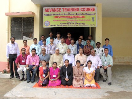
In recent training course on Geomatics, there were 19 participants from 14 States of India and 5 were localites. According to the Co-ordinator of this course, there were more than 200 applicants but the selection committee - experts in the subject have selected only 20 candidates.
The criteria given by DST (Dept. of Science & Technology) for selecting the candidates were as follows:
- One candidate from one State
- One candidate from one institute
- 10 candidates from Geography background and others from non-geography background (Geoscience and social sciences)
There are many Organizations and institution from NE but it seems they are not aware of the application of Geomatics (Remote Sensing and GIS etc) in different fields because only the IIG Shillong have sent one candidate.
It is interesting to note that even though there were two candidates applied for this training course and one came for this course but he does not belong to north eastern States. So there was not a single participant from Northeastern people who represents the North Eastern States of India. I belong to Manipur State but I represented the Maharashtra State (University of Pune) since I was selected from that State.
The advance course on "Application of Geomatics in Natural Resource Appraisal and Management" was sponsored by DST and all the participants were given TA and DA in addition to free course training in Geomatics.
Now the question is:
Will the northeastern people invest money to learn this kind of training course when they have not desire to learn in free of cost?
Why none of the north eastern people apply for this course?
Is that because of you didn't get the information or are you no eligible for this free training course?
There may be only a few young Geographers in N.E India but the opportunity was given to all Geoscience and allied disciplines, having workable computer knowledge. So the question doesn't arise that there is no young Geographers from N.E India.
Application in Remote Sensing and Geo - Informatics:
Agriculture: Mixed-crop discrimination and inventory, Large area crop inventory, Crop stress detection monitoring.
Forest: Types and species discrimination, Forest stock mapping Biomass estimation.
Environment: Environmental Impact Assessment (EIA) Monitoring sitting applications.
Urban Town and city mapping: Facility mapping,
Land use: Land use/Land cover mapping, Change detection,
Soil: Soil mapping, Erosion prone mapping,
Water Resources: Surface water monitoring, Ground water targeting, Command area management.
Disaster: Flood damage assessment, Flood relief measures etc.
If you are interested in doing this course, you may check out the different institutes like, Indian Institute of Remote Sensing, Dehradun and National Remote Sensing Agency, Hyderabad that offers this course. For more details about this course, you may find it from google search.
Reference:
- http://ess.nrcan.gc.ca/2002_2006/gsdnr/geomatics_e.php
- http://ess.nrcan.gc.ca/2002_2006/gsdnr/geomatics_e.php
* Dr. R.B. Thohe Pou ( PhD in Geography from University of Pune ) is a regular contributor to e-pao.net. He can be reached at thohepou(at)gmail(dot)com.
This was webcasted on 20th October 2008.
* Comments posted by users in this discussion thread and other parts of this site are opinions of the individuals posting them (whose user ID is displayed alongside) and not the views of e-pao.net. We strongly recommend that users exercise responsibility, sensitivity and caution over language while writing your opinions which will be seen and read by other users. Please read a complete Guideline on using comments on this website.


