TODAY -

Boundaries of Manipur : Some observation
- Part 1 -

Dr. RK Ranjan Singh *

Indo-Myanmar border near Moreh (border pillar #79 and #81 covering a distance of 10 Kms) :: July 2013
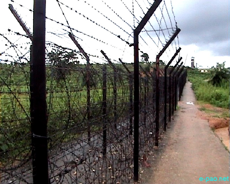
Indo-Myanmar border near Moreh (border pillar #79 and #81 covering a distance of 10 Kms) in July 2013 :: Pix - Somerendro Sorokhaibam


Changes in the function of boundaries throughout history help to illuminate differences in the nature and patterns of interaction of different domestic and international systems. However, boundaries are virtually observing as universal recognition of territorial sovereignty and an organising principle of international politics. On the other hand, because of the growth of trans-national relation and interdependencies, there is a tendency toward erosion of the exclusively associated with the traditional notion of territoriality.

On-going process of globalisation, free trade, regionalism and regional cooperation, the existence of boundaries and functional qualities were neglecting. But still then to protect a nation and its identities as a country or a nation state or communities, at least a well-recognised territorial boundary is essential. As for example, the native state of Manipur had existed for two millennia and her independent and sovereign status had been given international recognition since 1726 A.D. and 1826 A.D. onwards with the emergence of the modern nation system in the world.

However, the territorial boundary of Manipur has been fluctuated from time to time through a series of historical events, malpractices and processes. In this context we may recall some of the historical description of boundaries of Manipur as follows:

Status in 1475-1749: The available records shows that Maharaja Kyamba the Kyamlamjao (Kabaw Valley) was within the territory of the then Manipur (1475 t0 1714). Then during the reigned of Maharaja Pamheiba (Gaurabniwas 1714-1749) the frontiers of Manipur extended up to the confluence of the Chindwin and the Irrawaddy River of the present Myanmar.

The Anglo-Manipuri defence treaty of 1762 affirms that Manipur’s territory extends deep into Burma and even up to the banks of the Brahmaputra River in Assam. Status in 1832-1835:

"The territories of Muneepoor have fluctuated at various times with the fortunes of their princes, frequently extending three or four days journey east beyond the Ningthee or Khyendwen River, and west to the plains of Cachar. Its present boundaries, as far as they have been fixed are, on the west, the Jeeree River, from its sources to its confluence with the Barak, and from this point, south, to the north of the Chikoo or Tooyaee, a nullah, which flowing from lofty ranges bordering on the Tripurah country, falls into the Barak at the southern extremity of a range of mountains........

The confluence of the Tooyaee with the Barak......., as it marks the union of boundary of no less than three states, those of Muneepoor, Cachar and Tripurah. From this point, the southern boundary of the Muneepoor Territory is very irregular and ill defined" (Report on The Eastern Frontier of British India- Cap.R.B. Pemberton-1835).

The territorial possession of Manipur in the north extended far and wide. Even in 1832 the Government of Bengal inclined to make over the whole of Sadiya regions to Gambhir Singh, the then Raja of Manipur. In the same year Gambhir Singh, accompanied by Lieutenant Gordon, the then Adjutant, Manipur Levy, reduced to submission the Angami Nagas. Records show the fact that in 1835 the forest between Doyeng and Dhunsiri formed the boundary between Manipur and Assam (Lahiri, R.M., Annexation of Burma, P. 110).

In 1842 a kind of vague boundary, between Manipur and Naga Hills, was laid down by Lieutenant Bigge from the British side and Captain Gordon as the representative of the Government of Manipur.

But after the Treaty of Peace signed at Yandabo, 24th February 1826

(A) Burma also ceded the province of Tenasserim, thereby restricting Burmese access to the sea to the Irrawaddy delta area and also recognition of Manipur an independent native State. However, difficulties over the boundary of Manipur, did not end with the signing of the treaty.

(B) Agreement regarding the Kabaw Valley negotiated at Sunnyachi GhatJanuary 9, 1834. In this year the British agreed to return the Kabaw valley to Burma. Commissioners sent in 1833 negotiated an agreement delimiting the boundary along the foothills of the ranges to the west of the Kabaw valley. With later refinements, this boundary line has become a part of the present border. The boundary is referred to as Pemberton Line, named for the junior British Commissioner.

In 1894, the Manipur – Chin Hills boundary was demarcated, and in 1896 Col. Maxwell redemarcated the Pemberton – Johnstone area, placing thirty-eight pillars on the ground.

This has been referred to by number in the 1967 agreement After Sunnyachi Ghat January 9, 1834 Burmese were allowed to occupy the Kabaw Valley with payment of Rs. 6000 per annum to Manipur. (In 1953, Prime Minister Jawaharlal Nehru allows to discontinue the payment of Kabaw valley to Manipur.) Since then the map of Manipur has been drastically receded to the western foothill of the Kyam Lamjao (Kabaw Valley).

After the Anglo-Manipuri War of 1891 the territorial boundary was made a significant change as per the administrative continence of the British. Subsequently, in the year 1894 the Somra Track of Manipur along with 12 villages of Tangkhul was handed over to Burma (Somra, Phungret, Ngachand, Hingkok, Chakprum, Tonsa, Mayanglong, Leiyung, Kongailong, Koki, Numityungbi and Leishi).

Manipur signed the merger agreement on 21st September, 1949 and 15th October 1950 the native state of Manipur is under the Dominion of India. The protection and control of the territorial boundary of the state is as per desired of Government of India. Then the Survey of India makes changed places name and boundary against the interest of the people of Manipur, creating series of conflicts with the neighbouring state and country. Endless boundary dispute are lingering in the areas of Dzuku Valley, Tungjoi of Senapati, Jessami and Wahong of Ukhrul with Nagaland and Jiri River ofJiribam of Imphal East District with Assam.

Further, Molcham in Chandel, Charo Khunou in Ukhrul the Imphal have been conflicting with Burma (Myanmar). In this context we may recall some of the comment made by Late Shreejut Maharajkumar Prya Brata Singh (Chief Minister 1948-49) that at the beginning of his tenure the then Burmese Army fixed their Flag just at the point of the present Custom Office at Moreh. He asked the Burmese troop to remove the flag immediately. After that the troop removed the flag and then fixed on the left bank of the Lokchao River where the present Burmese immigration office is now located.

India-Burma Boundary Agreement:

The Burma-India Boundary has been delimited in great detail by a bilateral treaty signed at Rangoon on March 10, 1967, and delimited the international boundary between the two countries without respecting the native peoples and their villages on the spot. On the spot demarcation for negotiation and agreement there was a not representative from the concerned state. However, it is said that the 1967 boundary follows the "traditional" line between the two countries while rendering with precision two formerly identified areas. Almost 60 per cent of the 1,643 kilometre long boundary follows water divides, both major and minor, while nearly one-third coincides with median lines of frontier streams and rivers.

The remainder of the border comprises straight line between the previously established boundary pillars. However, Kangpat Khullen Villagers (00195100 Location Code of 2011 Census) reported that the present BP no. 94, 95, 96 and 97 were erected against the traditional boundary line by the Burmese Army. As a result five villages namely Mantaoram, Cheiteram, Sekawaram, Sanamram and karatram have been included in the Burmese territory. After the signed of India and Burma boundary agreement then formally delimit and demarcated the entire boundary between two countries. Both the government again rectified the Agreement and the Instruments of Ratification were exchanged in New Delhi on 30th May 1967. Soon after, there was disagreement on the position of Moreh, which Burma claimed, later solved by mutual discussion.

To be continued...


* Dr. RK Ranjan Singh wrote this article for The Sangai Express
The writer is Senior visiting fellow, Geography department, MU
This article was posted on September 08, 2013.


* Comments posted by users in this discussion thread and other parts of this site are opinions of the individuals posting them (whose user ID is displayed alongside) and not the views of e-pao.net. We strongly recommend that users exercise responsibility, sensitivity and caution over language while writing your opinions which will be seen and read by other users. Please read a complete Guideline on using comments on this website.


LATEST IN E-PAO.NET
  • 76th Indian Republic Day #4 : Gallery
  • Violence in Manipur 2023-2025 : Timeline
  • Featured Front Page Photo 2025 #2: Gallery
  • Lamphelpat Project: Flood control & Tourism
  • Mrs Hume's Pheasant captured for 1st time
  • The hidden burden of dialysis in Manipur
  • You :: Poem
  • World Red Cross Day at Guwahati
  • Monitoring school vans
  • India destroys terror targets
  • Mera Houchongba @Kangla #2 : Gallery
  • Gaikanpou, Amuthoibi, Kamreng : eMing
  • The vanguards : IDP women & Meira Paibis
  • Imagining power, polity, & citizenship in India
  • Growing problem of pesticide residues in food
  • Panleukopenia: Leading cause of death in cat
  • Countdown to Shirui Lily Fest
  • Hesitancy in eastern frontier
  • Moirang Thoibi & women's empowerment
  • Mushroom Training @ Tarung : Gallery
  • Seminar: Earthquake Resistant Design
  • Manipur: Fire response with high-tech bikes
  • Hume's pheasant (Nongin) spotted in Shirui
  • On you go :: Poem
  • 2nd TDF Academy Series on Design Career
  • Front page news: Visit of Patra
  • Parleys for Govt formation bid to pacify public
  • Nongkhrang Ehanba @ Lilong : Gallery
  • True Measure of Success
  • 2nd anniv & echoes of wounded Kangleipak
  • Black Day - 3rd May observed at Shillong
  • Vanishing Lung Syndrome
  • Chicken neck on the plate
  • Abhigyanm's Play- "A Stupid Common Man"
  • Backbreaking roads in Imphal
  • Task cut out for PR regime, centre
  • People's Convention on 3rd May #1 : Gallery
  • May 3rd - "Resistance Day" at Bangalore
  • From Matam Esheis to Indie bands
  • AMFA, State trio shine at AIFF Awards 2025
  • Redlands :: Poem
  • Digital age is creation of e-libraries
  • Resignations from civil services
  • Looking back at the past 730 days
  • CSOs strike tough postures, IDPs suffer
  • Restore respect & dignity of the Kanglasa
  • Manipur unveils ropeway linking heritage
  • Reunion of 23rd souls at Ziro, AP
  • The Power of Poppy - 79 :: Poem
  • Indo-Pak ties at crossroad after Shimla Pact
  • Food to protect skin from UV Rays
  • Radio E-pao: New Channel - Khunung Eshei
  • Cross-Border Terrorism: The Invisible War
  • Moreh's Internally Displaced Persons (IDPs)
  • May 3 conflict: Aftermath & resilience
  • Reaffirms May 3 as "Manipur Peace Day"
  • CSR for Rural Transformation
  • Ongoing affairs since May 3, 2023
  • 2 years of conflict, no signs of resolution
  • Indo-Naga Talks (From 2012) :: Timeline
  • Day 4: Yaoshang Sports #2 : Gallery
  • UN Decade on Indigenous Peacebuilding
  • Imphal's Ring Road Project - faster city
  • Appeal: Turn May 3 into 'Peace Day'
  • Health equity fundamental to #endMalaria
  • Wanted : Regional party with root in Manipur
  • Nagaland ranks high in college in NE
  • Khongjom Day - April 23 #2 : Gallery
  • Managing Expectations Means ...
  • Suspension of IWT by India: reality checks
  • Pilgrims barred from entering 'Kuki territory'
  • Mushroom Cultivation training at Tarung
  • Preserving fertility for future : Freezing eggs
  • Roadblocks to bid for new Govt formation
  • Delhi, Raj Bhavan in the thick of it
  • The Waterbirds of Loktak Lake
  • May Calendar for Year 2025 : Tools
  • Tamenglong - beacon of communal harmony
  • Moreh & the promise of a shared future
  • Delimitation & NRC issues in Manipur
  • World Veterinary Day 2025
  • Manipur: Runners-Up at 4th Nat'l Futsal, Goa
  • Farce of a ban on single use plastic
  • Cold storage launch plan in food crop
  • Imoinu Erat Thouni @Kangla : Gallery
  • Sarungbam Athouba: Gold @Asian Triathlon
  • NID silence on Indigenous Design authorship
  • Negativity of over-positivity
  • The Deadliest Mind :: Poem
  • Buffalo breeding farm gathering dust
  • Needed: Consistent, correct narrative
  • Congress attacks, BJP unfazed
  • Bashanta Ras @Govindaji #1: Gallery
  • Pope Francis: A Man of our time
  • Who failed FNR? Or is it FNR which failed ?
  • Turning blinds eye to preventable epidemic
  • Civil servant Jerry the savior
  • Changing drug route to Mizoram
  • Outcries over false JJM claims
  • Statues of 7 Maichous @Kyamgei : Gallery
  • Yaoreishim showcases leather craftsmanship
  • Illicit poppy cultivation in Manipur
  • PWF: Election of New Office Bearers
  • Manipur boxers- 5 medals at Asian U-17
  • The Power of Poppy - 78 :: Poem
  • Meeteis are as Indian as any other citizen
  • Riya Khwairakpam : HSE Science Topper
  • Keisham Hannah : HSE Arts Topper
  • Warepam Lidia : HSE Commerce Topper
  • A challenge to India Security Framework
  • Step Back to Slingshot Forward
  • Manipur's path to climate resilience
  • "Delhi Fashion week" is Now official
  • Harvest of Hope :: Poem
  • Travel beauty tips for summer holidays
  • Credible show of the students
  • Kashmir matters, not Manipur
  • HSE 2025 Result : Science Full Result
  • HSE 2025 Result : Arts Full Result
  • HSE 2025 Result : Commerce Full Result
  • HSE 2025 Information / Abbreviation
  • HSE 2025 Topper : Science
  • HSE 2025 Topper : Arts
  • HSE 2025 Topper : Commerce
  • HSE 2025 : Pass Percentage
  • HSE 2025 : Result Abstract
  • HSE 2025 : Candidates with Highest Marks
  • Khongjom Day - April 23 #1 : Gallery
  • Thang Ta finds new energy amid peace
  • Tawang: Geostrategic importance for India
  • Thadou appeal for community understanding
  • Census 2001 & delimitation in Manipur
  • Condemns Pahalgam Terror- Calls for Action
  • Failing to read & control situation
  • Visible efforts essential for public trust
  • MK Binodini Devi's short story 'Tune'
  • Prof Moirangthem Marjit chairs SETSM, Hanoi
  • Will the two Asian giants always be in Rivalry?
  • Rebellion surfaces in rebel group NSCN-IM
  • Child Labour :: Poem
  • Pharmaceutical Waste: Threat to public health
  • Call for delimitation, NRC : Check illegal
  • Death knell for noble healthcare schemes
  • 175th Anniv- Maharaj Narasingh #2 : Gallery
  • World Earth Day : Gallery
  • Understand Suicide & Mental Health Support
  • Manipur champion @ Natl School Games
  • World Earth Day celebrated at MTU
  • The Earth Day 2025: Our power, our planet
  • How long will PR continue ?
  • Eviction drive need of the hour
  • Tamnalai : World Theater Day #1: Gallery
  • Chumthang Makhong : Play Synopsis
  • The demands of village volunteers
  • Missing you :: Poem
  • AI offers hope for beekeepers battling pest
  • Rural women, climate shock: Beijing report
  • From March 8, 2025 to April 22, 2025
  • The Power of Confident Communication
  • 2nd State Level Soccer Futsal Championship
  • April 21: National Public Relations Day
  • The resurrection of Jesus & its impact
  • Bhalla saab solution kithe ?
  • Training on Mushroom Cultivation
  • JNIMS turned into a dumping site
  • Sub-par work as centre vows US-level roads
  • Cheiraoba by Manipuri in Korea : Gallery
  • Sri Lanka "Ayubowan" lasting impression
  • GoI must prepare to handle post-Muivah
  • Vice President felicitated Mughavi Tuccu
  • The Power of Poppy - 77 :: Poem
  • Rabies outbreak in Manipur
  • Athoubashinggi Numit #2 : Gallery
  • Pangolin & fight against Climate Change
  • Condemn violent assault against Konsakhul
  • Spring's symphony in my farmhouse :: Poem
  • National Conference on Elderly at RGU
  • The corruption & materialism of Judas
  • Manipur under PR for over 2 months
  • Bid to form government amid public scrutiny
  • 175th Anniv- Maharaj Narasingh #1 : Gallery
  • AI & technology in Manipur's agriculture
  • 4 Manipur players in Indian Women's Hockey
  • Gender justice & health equity are linked but ...
  • Digital marketing: Oxygen of modern business
  • Spring fruits that boost collagen in your body
  • Pot holed roads & others: Surviving Manipur
  • Frustration over centre failure to resolve crisis
  • Pichakari @Govindajee Temple #2 : Gallery
  • Poshan Pakhwada @ MU : Gallery
  • Startup Surge Manipur: Startup Venture Fund
  • My messy room :: Poem
  • Why WAQF Act, 2025 is unconstitutional
  • Emerging politics at play
  • National Fire Service Week
  • Observance of Thang-Ta Day #2 : Gallery
  • Cheiraoba in South Korea
  • Festival of Maram Achouba Khoushaba
  • The Hidden Strength in Falling Short
  • World Health Day 2025 & our Environment
  • Career after marriage: Flight or confusion?
  • Ban on SUP has come into force
  • Preying on abandoned houses
  • Sajibu Cheiraoba Chak Katpa #2 : Gallery
  • Athoubashinggi Numit #1 : Gallery
  • Day 4 : Yaoshang Sports #1 : Gallery
  • Cheirao-chingkaba @Chinga : Gallery
  • 16th Annual Art Exhibition #1: Gallery
  • Ougri Lirol :: Part 1 : Ooba Video
  • Mei Loukhatpa @Laipubam : Gallery
  • Indigenous People's Fest #2 : Gallery
  • Delimitation based on Census 2001 - II
  • Yaoshang Halankar #1 : Gallery
  • Yaoshang Mei Thaba #3 : Gallery
  • Supreme Court Judges visit : Gallery
  • Shortcomings - Delimitation in Manipur
  • Sajibu Cheiraoba Chak Katpa #1 : Gallery
  • MoU with Nittur IAS Academy
  • Yaoshang Sports @ Kwakeithel #2 : Gallery
  • Saroi Khangba @ Imphal #2 : Gallery
  • Yaoshang Pichakari #2 : Gallery
  • Yaoshang Mei Loukhatpa #4 : Gallery
  • Yaoshang Mei Loukhatpa @Kangla : Gallery
  • President's Rule in Manipur : 1967 - 2025
  • Meitei Mayek Tamba : Online Classroom #5
  • Downloadable Manipuri Calendar :: 2025
  • GHOST of PEACE :: Download Booklet